
Overview
Crop identification and Crop Area Estimation
- Operational crop area estimation for winter (Wheat, Barley) and summer (Maize, sunflower, sorghum, soya and dry beans) crops continue. This data is fed to the national Crop Estimations Committee. Operational systems are continually improved as technologies and systems become available. Satellite imagery is used to delineate and update the national cultivated field database as well as to selectively classify crop type.
- Crop condition/ stress
The Umlindi system, based on course resolution imagery (Proba V and Modis) and in situ (weather station data) continues to issue its monthly newsletter on drought monitoring, crop condition and other relevant information. The system is continually improved as new indices are incorporated.
- Soil moisture
The Umlindi system issues a monthly soil water product generated using the Topkapi model run by the University of KwaZulu-Natal. A number of soil water sensors have also been added to some of the automatic weather stations located in the JECAM site.
- Yield prediction and forecasting
Yield data for wheat and maize is also operationally collected and all this data is fed to the national Crop Estimations Committee for monthly national production estimates. Operational systems are continually improved as technologies and systems become available.
- Crop Residue, Tillage and Crop Cover Mapping
Not currently addressed due to resource constraints.
The mapping resolution is around 1:50 000.
The timeliness (with regards to growing season) are:
- Summer crops – Planted December, Harvest May/June
- Winter Crops – Planted April May, Harvested October November
Project Objectives
Estimating Crop Area
Operational Implementation Plan
Field size measurement
Estimating Crop Conditions
Operational Implementation Plan
Crop Conditions
- Too wet to be seeded
- Drought
- Failure after germination
- Biological Stress
Estimation of Biophysical Variables
Operational Implementation Plan
Biophysical Variables
- Residue and Tillage mapping
Forecasting Agricultural Variables
Operational Implementation Plan
Agricultural Variables (large scale)
- Yield
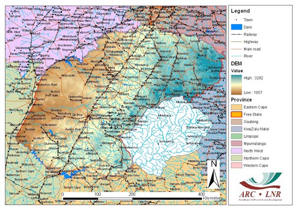
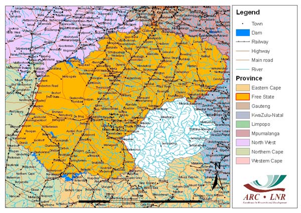
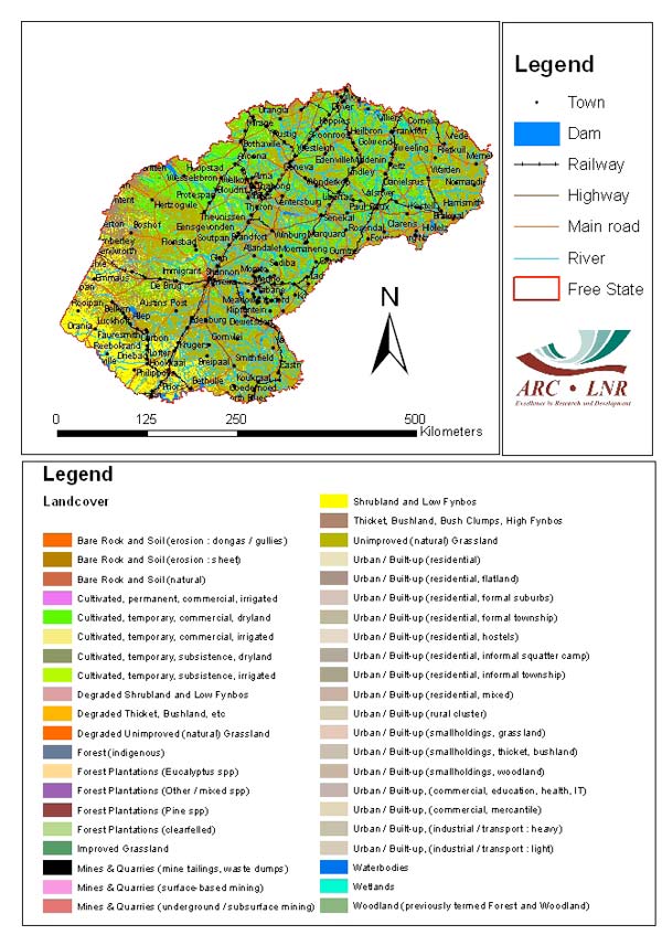
Site Description
| Landscape Topography | Ranges from flat undulating plains to mountainous in the east |
|---|---|
| Typical Field Size | 0.5 ha to 40 Ha |
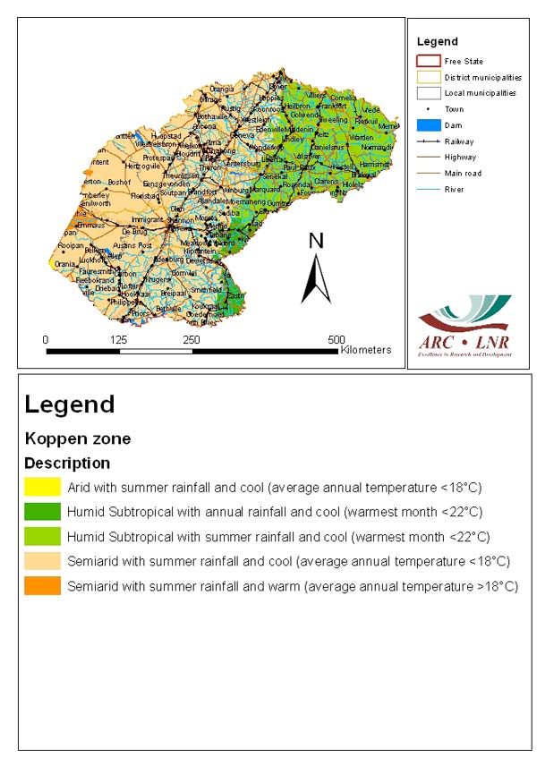
| Climatic Zone | Subtropics, warm/ mod cool |
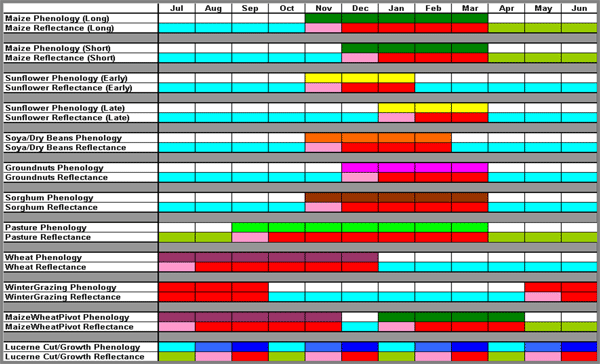
| Major Crops and Calendars | Maize (Early): Maize (Normal): Sunflower (Early): Sunflower (Late): Soya beans (Normal): Groundnuts (Normal): Sorghum (Normal): Pasture (Normal): Wheat (Normal): Forage (Normal): Alfalfa (Normal): Oats (Normal): |
| Soil Type & Texture | Inorganic:
|
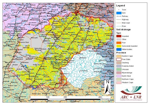
| Soil Drainage Class | ["Well drained","Moderately well drained","Imperfectly drained","Poorly drained","Very poorly drained"] |
| Irrigation Infrastructure | ["Center pivot irrigation"] |
| Other Site Details | Typical Crop calendar (Colours in lower rows simulate CIR imagery)
Topography of the Free State Province
|
In Situ Observations
Temperature, Humidity, Rainfall, Solar Radiation, Wind, Potential evapotranspiration (derived)
- Crop Type(s):
- Collection Protocol:
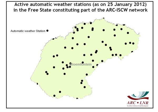
Weather station data from the automatic weather station network of the ARC-ISCW have been collected at/near each of the 2 sub-sites.
- Frequency:
Yield measurements
- Crop Type(s):
- Collection Protocol:
Routinely collected at a random number of points
- Frequency: 150 summer, 70 Winter
EO Data
Optical Data Requirements
SAR Data Requirements
Passive Microwave Data Requirements
Thermal Data Requirements
Results
Documents and Files
Links to paper
Project Reports
Study Team
Team Leader
Other Team Members