Overview
Project Objectives
Mapping Agricultural Areas
Operational Implementation Plan
Mapping Agricultural Areas: Cropped LandResolution (minimum mapping unit): 5ha and 1haMapping Frequency: once within growing seasonPasture/RangelandResolution (minimum mapping unit): 5ha and 1haMapping Frequency: yearly
Scale
Land Cover
- Spatial Resolution:
- Temporal Resolution:
Estimating Crop Area
Operational Implementation Plan
Crop area estimations are planned to be done at least on region-level (kray level), on farm level at several cases
Field size measurement
ha
Estimating Crop Conditions
Operational Implementation Plan
Crop Conditions
- Too wet to be seeded
- Drought
- Failure after germination
- Biological Stress
Measuring Phenological Events
Operational Implementation Plan
Phenological Events
- Seeding
- Seedling
- Vegetative Growth
- Flowering
- Fruit Development
- Maturity
- Harvest
Estimation of Biophysical Variables
Operational Implementation Plan
Biophysical Variables
- Vegetation Indices (NDVI, EVI, SAVI, etc.)
- fAPAR (Fraction of Absorbed Photosynthetically Active Radiation)
- LAI (Leaf Area Index)
- Biomass
Forecasting Agricultural Variables
Operational Implementation Plan
Agricultural Variables (large scale)
Site Description
| Landscape Topography | |
|---|---|
| Typical Field Size | 30 - 130 ha |
| Climatic Zone | Temperate, cold |
| Major Crops and Calendars | Fallows (Normal): Peas (Normal): Winter Wheat (Normal): Winter rapeseed (Normal): Spring Barley (Normal): Winter Barley (Normal): Soya beans (Normal): Sunflower (Normal): |
| Soil Type & Texture | Inorganic:
|
| Soil Drainage Class | ["Well drained","Moderately well drained","Imperfectly drained","Poorly drained"] |
| Irrigation Infrastructure | ["No irrigation (precipitation)"] |
| Other Site Details |
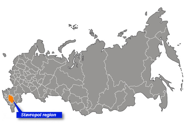
Fig. 1 Location of Stavropol kray, regional level
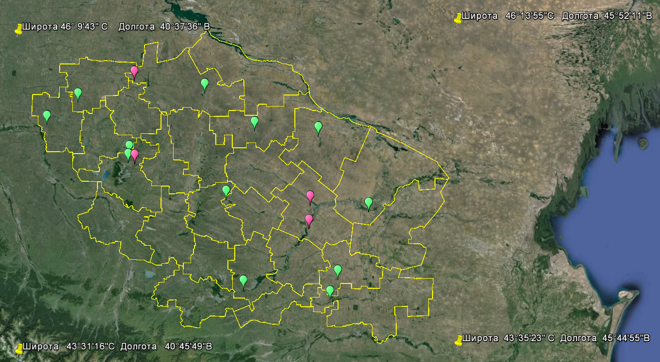
Fig. 2 Sub-sites (experimental fields), local level
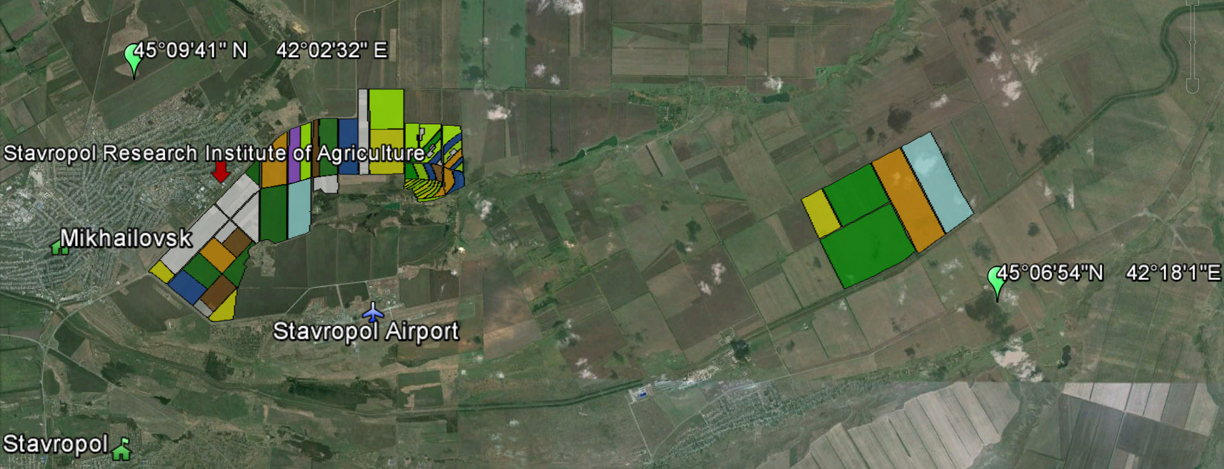
Fig 3. Sub-sites of the Stavropol Research Institute for Agriculture. Other Site Specifications: High potential risk of wind (95%) and water (82%) erosion; joint manifestation of both types of erosion is 77% of kray territory. Large areas in Stavropol kray are affected by salinity of various degrees with chloride-sulphate, sulphate and sulphate-chloride type of salinity. Agricultural methods used: Crop types are spring/winter wheat, spring/winter barley, peas, soybean, sunflower, winter rapeseed, perennial grasses. Typical crop rotation is: fallow/peas – winter wheat – winter rapeseed – winter wheat. Farming methods are no-till and tillage-based. Large areas are affected by salinity of various degrees with chloride-sulphate, sulphate and sulphate-chloride type of salinity. |
In Situ Observations
Crop type
- Crop Type(s):
- Collection Protocol:
Field survey
- Frequency: Once within vegetation season
Temperature, Precipitation, Soil Moisture, humus, NPK
- Crop Type(s):
- Collection Protocol:
Meteo-station data
- Frequency: daily
LAI, fCover, fAPAR
- Crop Type(s):
- Collection Protocol:
Fisheye pictures processed
- Frequency: once a week
EO Data
Optical Data Requirements
SAR Data Requirements
Passive Microwave Data Requirements
Thermal Data Requirements
Results
Documents and Files
Links to paper
Project Reports
Study Team
Team Leader
Other Team Members


