Overview
This involves data collection on biophysical parameters and phenology of Maize in Northern Ghana.
Data Collection
- Li-Cor LAI leaf analyzer to monitor leaf area index (LAI).
- SPAD (chlorophyll) meter to monitor chlorophyll content.
- Crop yield measurement.
Field data collection began at the beginning of the planting season and continued until maize tasseling.
The biophysical and phenological data are collected weekly.
Project Objectives
Mapping Agricultural Areas
Operational Implementation Plan
Scale
Estimating Crop Area
Operational Implementation Plan
Field size measurement
Acre
Measuring Phenological Events
Operational Implementation Plan
Monitoring and measurement of phenological occurrences such as seedling emergence, vegetative development, flowering, and fruiting.
Phenological Events
- Seedling
- Vegetative Growth
- Flowering
- Fruit Development
- Maturity
- Harvest
Estimation of Biophysical Variables
Operational Implementation Plan
Biophysical Variables
- Vegetation Indices (NDVI, EVI, SAVI, etc.)
- LAI (Leaf Area Index)
Forecasting Agricultural Variables
Operational Implementation Plan
Agricultural Variables (large scale)
- Yield
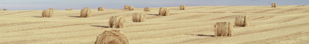
Site Description
| Landscape Topography | |
|---|---|
| Typical Field Size | 1 acre and above |
| Climatic Zone | Tropics, warm |
| Major Crops and Calendars | Maize (Normal): |
| Soil Type & Texture | Inorganic:
|
| Soil Drainage Class | |
| Irrigation Infrastructure | No irrigation |
| Other Site Details |
In Situ Observations
LAI
- Crop Type(s): Maize
- Collection Protocol:
Li-Cor LAI leaf analyzer
- Frequency: weekly
Chlorophyll
- Crop Type(s): Maize
- Collection Protocol:
SPAD (Chlorophyll) meter
- Frequency: weekly
Crop yield measurement
- Crop Type(s): Maize
- Collection Protocol:
- Frequency:
EO Data
Optical Data Requirements
SAR Data Requirements
Passive Microwave Data Requirements
Thermal Data Requirements
Results
Documents and Files
Links to paper
The selected farms were mapped, and biophysical data of LAI and chlorophyll were collected. Ground-truth data were used to validate the satellite data sets. A crop yield estimation model was developed based on the collected field data and satellite / EO data. The model was designed to provide timely yield estimates.
Gómez-Dans, J. L., Lewis, P. E., Yin, F., Asare, K., Lamptey, P., Aidoo, K. K. Y., MacCarthy, D. S., Ma, H., Wu, Q., Addi, M., Aboagye-Ntow, S., Doe, C. E., Alhassan, R., Kankam-Boadu, I., Huang, J., and Li, X.: Location, biophysical and agronomic parameters for croplands in northern Ghana, Earth Syst. Sci. Data, 14, 5387–5410, https://doi.org/10.5194/essd-14-5387-2022, 2022.
Project Reports
Study Team
Team Leader
Other Team Members