Overview
The site is centered at the San Antonio de Areco county -Buenos Aires province- and encompasses an area of intense surveys and field measurements of ca. 20 x 20 km bounded by an extended area of 70 x 70 km with annual crop type observations. Operational activities started in 2010 and can be grouped as follows:
- Crop identification and Crop Area Estimation: Crop identification. We are testing several classification methods using optical images and RADAR images and its combination. During last campaign we continued obtaining data from the original JECAM/ SIGMA area as well as over a minimum dataset (MDS) area of 20 x 20 km with higher density collection. This small area matches with RADARSAT-2 Fine Quad Pol acquisitions during this campaign that we are collecting for the SAR intercomparrison experiment. We developed an intercomparisson of methodologies for cropland identification together with other JECAM/ SIGMA sites (China, Russiz, Ukraine, Brazil, and Belgium). We are moving from local to regional estimation of crop land and crop type. We are testing different sampling methodologies and different data sources together with other JECAM sites.
For Growing Season 2018-2019 we expanded the on-road JECAM like surveys to all the agricultural area of Argentina (LINK). - Characterization of Crop Rotations: From annual crop type maps along seven yars, Crop rotations maps were generated to analize the occurrence of monoculture and crop rotation. A manuscript was plublished in 2020.
- Soil Moisture: Analysis of its effects on RADAR signal.
- Yield Prediction and Forecasting: We are working in an intercomparisson study for yield estimation at coutry level with SIGMA/ JECAM partners from Russia, China, Ukraine, and Africa leaded by Alterra (Wageningen, The Netherlands). We are also working in the estimation of biophysical parameters at field level using optical and RADAR images.
Project Objectives
Mapping Agricultural Areas
Operational Implementation Plan
Crop identification. We are testing several classification methods using optical images and RADAR images and its combination. During last campaign we continued obtaining data from the original JECAM/ SIGMA area as well as over a minimum dataset (MDS) area of 20 x 20 km with higher density collection. This small area matches with RADARSAT-2 Fine Quad Pol acquisitions during this campaign that we are collecting for the SAR inter-comparison experiment. We developed an inter-comparison of methodologies for cropland identification together with other JECAM/ SIGMA sites (China, Russia, Ukraine, Brazil, and Belgium). We are moving from local to regional estimation of crop land and crop type. We are testing different sampling methodologies and different data sources together with other JECAM sites.
Scale
Forecasting Agricultural Variables
Operational Implementation Plan
Agricultural Variables (large scale)
- Yield
- Soil Moisture
- Crop rotation
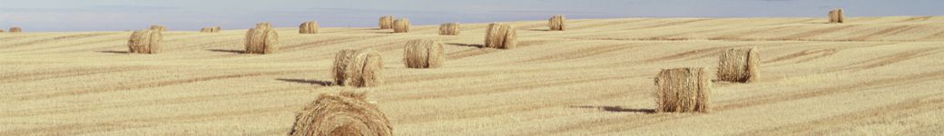
Site Description
| Landscape Topography | Gently slopes (lower than 3%) |
|---|---|
| Typical Field Size | Average field size is ca. 20 ha. However plot size is very variable. |
| Climatic Zone | Temperate, cool |
| Major Crops and Calendars | Wheat (Early): Soybean (Early,Late): Maize (Early): Maize (Normal): Soybean (Late): Wheat (Late): |
| Soil Type & Texture | Inorganic:
|
| Soil Drainage Class | ["Well drained"] |
| Irrigation Infrastructure | ["No irrigation (precipitation)"] |
| Other Site Details | Mostly no till agriculture. Main rotation (three years): Maize, Soybean, Wheat/Soybean Soil classification: Mostly Mollisols |
In Situ Observations
Crop Inventory
- Crop Type(s): Soybean, Maize, Wheat
- Collection Protocol:
On road surveys were performed at least twice a year to identify winter and summer crops as well as fallows, pastures and grasslands. Surveys are performed over the JECAM/SIGMA area (100×100 Km) and with a higher collection density over MDS area (20×20 Km). Other in situ data sources are being collected in other areas of Argentina to expand the classification methodologies to other areas and get regional maps.
- Frequency: Biannually
EO Data
Optical Data Requirements
SAR Data Requirements
Passive Microwave Data Requirements
Thermal Data Requirements
Results
Documents and Files
Poster-MNC.pdf mapa_nacional_de_cultivos_campana_2018_2019.pdf protocolo_relevamientos_MNC.pdfLinks to paper
de Abelleyra, D., Veron, S., Banchero, S., Mosciaro, M. J., Propato, T., Ferraina, A., … & Volante, J. (2020, March). First Large Extent and High Resolution Cropland and Crop Type Map of Argentina. In 2020 IEEE Latin American GRSS & ISPRS Remote Sensing Conference (LAGIRS) (pp. 392-396). IEEE. LINK
de Abelleyra, D., & Verón, S. (2020). Crop rotations in the Rolling Pampas: Characterization, spatial pattern and its potential controls. Remote Sensing Applications: Society and Environment, 100320. LINK
Dingle Robertson, L., Davidson, A., McNairn, H., Hosseini, M., Mitchell, S., De Abelleyra, D., Verón, S., & Cosh, M. H. (2020). Synthetic Aperture Radar (SAR) image processing for operational space-based agriculture mapping. International Journal of Remote Sensing, 41(18), 7112-7144. LINK
de Abelleyra D, Banchero S, Verón S, Mosciaro J, Volante J. (2019). Mapa Nacional de Cultivos campaña 2018/2019. Collección 1. Versión 1. Informe. Instituto Nacional de Tecnología Agropecuaria (INTA), Argentina. Pdf Map VIEWER
de Abelleyra D, Verón S, Banchero S, Helena H, Mosciaro M, Noe Y, Vale L, Morales C, Gaitán J, Volante J. (2019) Towards the generation of National Crop Type maps in Argentina. ESA Living Planet Sympossium 2019. Milan, Italy. 13-17 May, 2019. LINK
Dingle Robertson, L., Davidson, A., McNairn, H., Hosseini, M., Mitchell, S., de Abelleyra, D., Verón, S., Cosh, M.H. (2018). SAR speckle filtering and agriculture field size: Development of sar data processing best practices for the JECAM SAR intercomparison experiment. Proceedings of the International Geoscience and Remote Sensing Symposium: 3828-3831. 10.1109/IGARSS.2018.8519299.LINK
Project Reports
Study Team
Team Leader
Other Team Members