Overview
Project Objectives
- Crop identification and crop acreage estimation: millet, groundnuts and maize
- New sub-objectives: Crops and trees temporal evolution since 1968
- Crop Condition/Stress
- Soil moisture: Joor and Deck soils
- Other: Delineation and identification of trees and shrubby vegetation.
Project Objectives
Mapping Agricultural Areas
Operational Implementation Plan
Scale
Land Cover
- Spatial Resolution:
- Temporal Resolution:
Estimating Crop Conditions
Operational Implementation Plan
Crop Conditions
- Biological Stress
Estimation of Biophysical Variables
Operational Implementation Plan
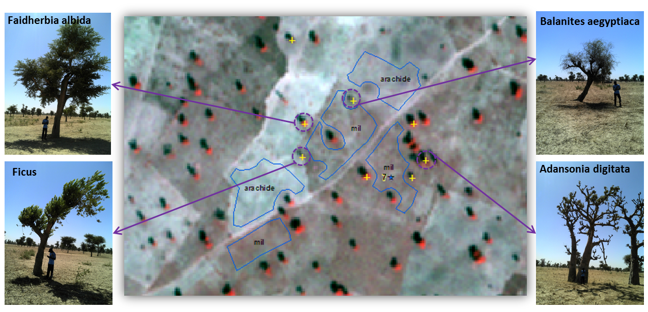
Vegetation field data collected in Bambey study area and used for satellite image processing was as follows. Table 1 Vegetation Field Data Collected in Bambey Study AreaFor each culture and trees, we collected geographic information with the GPS, the types, the species and the states of the culture or tree (Figure 1). Weekly rainfall data from 2013 to 2015 was collected by the ISRA/CNRA Bambey Institute.
 Figure 1 Pléiades Image Showing Different Tree Species in Bambey Study Area Plans for Next Growing SeasonTo build on these first results in the near future, and especially to improve identification of trees, we plan to use satellite images with a richness of bands and a high revisit time, such as the Sentinel-2 sensors which have 13 spectral bands during the dry season when trees are leafy.
Biophysical Variables
- Biomass
Forecasting Agricultural Variables
Operational Implementation Plan
Agricultural Variables (large scale)
- Temporal Change
Site Description
| Landscape Topography | Low slope, 30 m mean elevation |
|---|---|
| Typical Field Size | Around 200m2 |
| Climatic Zone | Subtropics, warm/ mod cool |
| Major Crops and Calendars | Millets (Normal): Groundnuts (Normal): Maize (Normal): |
| Soil Type & Texture | Inorganic:
|
| Soil Drainage Class | ["Very poorly drained"] |
| Irrigation Infrastructure | ["No irrigation (precipitation)"] |
| Other Site Details | Low level mechanization dominated by drought animal and manual labour
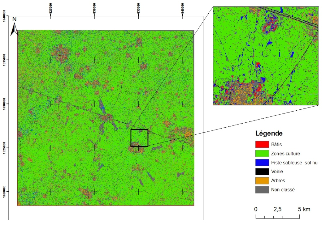
Figure 1: Land cover map of Bambey study area |
In Situ Observations
species, size, density, height, phenoloical activity, geolocation
- Crop Type(s):
- Collection Protocol:
Field surveys were conducted during February 2013, 2014 during the dry season when trees are leafy, and in September 2014 corresponding to the crop growing season
- Frequency:
EO Data
Optical Data Requirements
SAR Data Requirements
Passive Microwave Data Requirements
Thermal Data Requirements
Results
Documents and Files
Links to paper
Project Reports
Study Team
Team Leader
Other Team Members

