Overview
Tensift, Morocco – The Haouz Plain
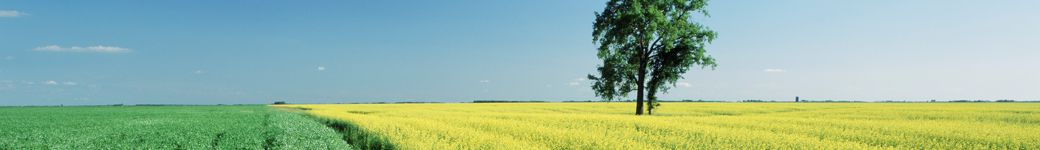
The semi-arid agricultural plain of the Haouz, in the Tensift Watershed in Morocco is the most important area in terms of potential water savings, and 85% of the mobilized water is used for irrigation. It includes traditional and modern irrigation, flood and drip irrigation, with water coming either from dams, river diversion or groundwater abstraction. The vegetation is composed of tree plantations (mainly olive groves and oranges) and annual crops (cereals, market gardening) or multi (alfalfa) frequently grown in sub-stratum of trees. The extent and location of the annual crops vary from one year to another, depending on water availability. In the semi-arid agricultural plain, the challenge is to understand the functioning of water surfaces (mainly vertical water flow), in conjunction with plant production, following a series of questions of increasing complexity: Estimation of the actual evapotranspiration? Partition between soil evaporation and transpiration covered? Assessment of water needs of crops? Evaluation of volumes of irrigation water in discerning their origin? Evaluation of irrigation methods used?
Project Objectives
- Crop identification and Crop Area Estimation: Landcover maps at medium scale resolution from NDVI time series using either a thresholding algorithm, or an off-the-shelf algorithm for supervised classifications.
- Crop Condition/Stress: Methodological developments for the estimation and monitoring of surface states with multi-sensor, multi-spectral remote sensing of surfaces.
- Evapotranspiration from infrared thermal and visible data (FAO-56, energy budget approach).
- Soil Moisture: High resolution soil moisture, by disaggregation of SMOS satellite measurements based on thermal and visible data (Merlin et al., 2009, 2012, 2013).
- Yield Prediction and Forecasting: A PhD thesis is working on the forecasting of wheat yield at the plot level using empirical relations. At the regional level, through statistical analysis of different types of optical and micro-wave remote sensing, combined with climate data, different dynamic prediction models of vegetation cover and cereal yields have been proposed (Jarlan et al. , 2013, Mangiarotti et al., 2013)
- Others: Two main research areas are considered. The first is to better understand the integrated hydrological functioning across the watershed and to develop tools (digital platform modeling fed by satellite and ground observation) to predict the evolution of resources. The first focus is developed with strong scientific dynamics around the following points: (1) Modeling and analysis of the functioning of the main water flow (recharging process water, surface flows and particularly evapotranspiration, energy balance of the snow cover). In this context, we compare various approaches of evapotranspiration estimates with the level of complexity and the application for irrigation management. (2) Integrated modeling including conceptual and mechanistic modeling. (3) Satellite data assimilation into surface models. The second area focuses on the regional dimension of the problem of environmental hydro resources in the Mediterranean, and the need to produce indicators at this level in particular exploiting the remote sensing data. This area is developed around the following: (1) Methodological developments for the estimation and monitoring of surface states with multi-sensor, multi-spectral remote sensing of surfaces and (2) the characterization of indicators for better understanding of hydrological functioning. The work deals with predictability and the modeling of inter-annual variability.
Project Objectives
Estimation of Biophysical Variables
Operational Implementation Plan
Biophysical Variables
- Flux measurements
Forecasting Agricultural Variables
Operational Implementation Plan
Agricultural Variables (large scale)
- Yield
- Soil Moisture
Site Description
| Landscape Topography | Basin, plain and Mountainous |
|---|---|
| Typical Field Size | |
| Climatic Zone | Tropics, warm |
| Major Crops and Calendars | Winter Wheat (Normal): Sugar beet (Normal): Olives (Normal): Tangerines, Mandarines and Clementines (Normal): Grapes (Normal): Apricots (Normal): |
| Soil Type & Texture | Inorganic:
|
| Soil Drainage Class | |
| Irrigation Infrastructure | ["Surface irrigation","No irrigation (precipitation)"] |
| Other Site Details |
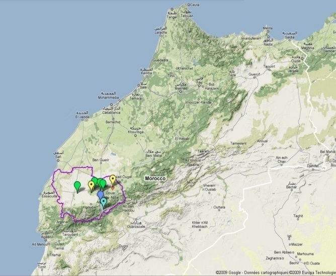
The watershed is located in the Tensift region of Marrakech in Morocco (Figure 1). Covering an area of about 20,000 km ², it is composed of 3 hydrological parts. South of the basin, the northern slopes of the Atlas is well-watered and snow (up to 600 mm / year). Peaking at over 4,000 m, those mountains are the water tower of the Haouz plain. In the center, a vast plain, characterized by a semi-arid climate (rainfall 250 mm / year), and where the water flows are predominantly vertical except for wadis and water infrastructures. The main irrigated areas are located in the central and eastern part (2000 km ²) and rainfed cereals is practiced on the rest of the plain. The cultivation of wheat is majority with over 80% of acreage covered followed by olive trees occupy about 13% of the plain, the remaining area being occupied by citrus, apricot, market gardens, vineyards, fodder . These proportions change significantly in the irrigated area where tree crops dominate. In the north, the small chain of arid mountains “Jbilets” has, in the present state of knowledge, little influence on the hydrological cycle in the region. Figure 1: location of the Tensift Watershed in Morocco
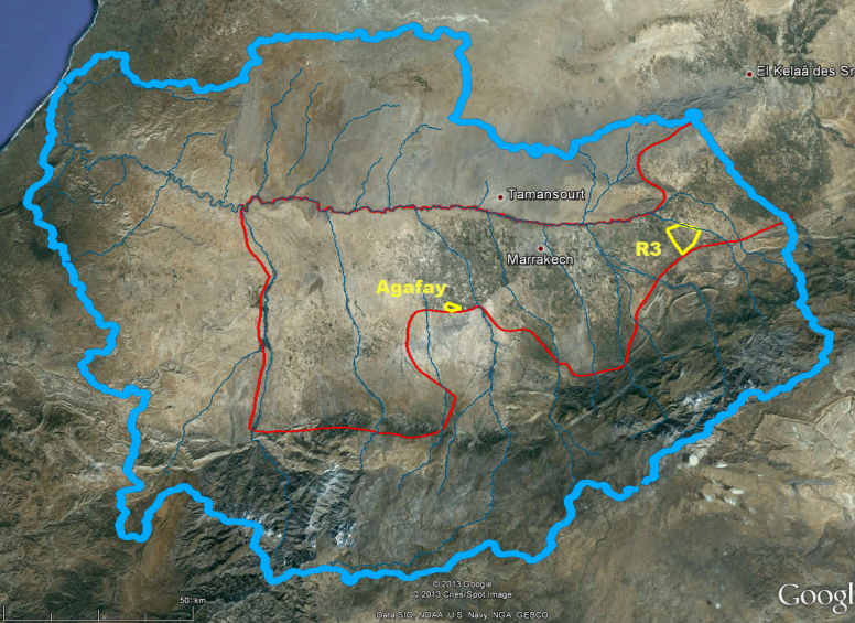
Figure 2: location of the Haouz plain and the two sites in the Tensift Watershed
Two test sites are considered for JECAM: The R3 sector is a 3000 ha area with flood irrigation on demand located 40 km east of Marrakech. The main crop is Winter Wheat. The other crops represent less than 20% of the cultivated area being Sugar Beet, Olive trees, etc. Soil texture is mainly Clay Loam. The growing season of winter wheat is December-June, sugar beet is from November to june, and Olive grove is evergreen with latency during the summer. The whole site have been under study since 2002 and benefited from several remote sensing campaigns with optical (SPOT, Landsat, Formosat), thermal (Aster, Landsat), and radar (ASAR) satellite timeseries.
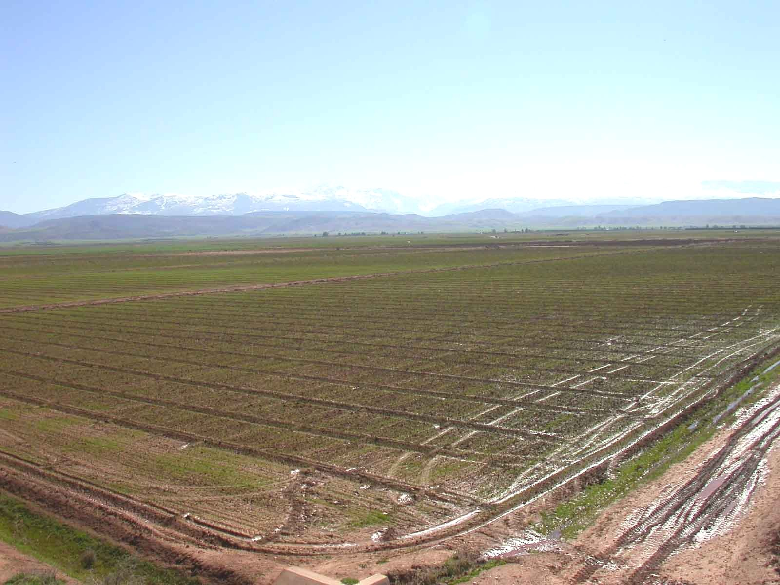
A picture of a wheat field in the Haouz plain of Marrakech, with the High Atlas Mountain in the back. |
In Situ Observations
Land Cover
- Crop Type(s):
- Collection Protocol:
Site: R3 and Agafay Survey Acquistion Mode: O Field Campaign: 2002, 2004, 2006, 2010.
- Frequency: Annual
Water and Energy Budget
- Crop Type(s):
- Collection Protocol:
Site: Intensive sites Turbulent fluxes Acquisition Mode: A
- Frequency: 30 min.
RH
- Crop Type(s):
- Collection Protocol:
Weather Site: 15 stations Weather Station Acquisition Mode: A
- Frequency: 30 min to 1 hour
Remote Sensing
- Crop Type(s):
- Collection Protocol:
Site: R3 and Agafay Survey Acquistion Mode: A Field Campaign: 2001-.
- Frequency: Annual
LE
- Crop Type(s):
- Collection Protocol:
Site: Intensive sites Turbulent fluxes Acquisition Mode: A
- Frequency: 30 min.
Ra
- Crop Type(s):
- Collection Protocol:
Site: 15 stations Weather Station Acquisition Mode: A
- Frequency: 30 min. to 1 hour
Plowing
- Crop Type(s):
- Collection Protocol:
Site: R3 Survey Acquisition Mode: O Field Campaign: Since 2006
- Frequency: Agricultural Season
Vertical profiles of temperature
- Crop Type(s):
- Collection Protocol:
Site: 15 stations Weather Station Acquisition Mode: A
- Frequency: 30 min. to1 hour
Sowing
- Crop Type(s):
- Collection Protocol:
Site: R3 Survey Acquisition Mode: O Field Campaign: Since 2006
- Frequency: Agricultural Season
Vertical profiles of humidity
- Crop Type(s):
- Collection Protocol:
Site: Intensive sites Reflectrometry probes Acquisition Mode: A
- Frequency: 30 min.
Rain
- Crop Type(s):
- Collection Protocol:
Site: 36 pluvios Pluviometer Acquisition Mode: O From 60’s for some pluviometers
- Frequency: Daily
Irrigation
- Crop Type(s):
- Collection Protocol:
Site: R3 Survey Acquisition Mode: O Field Campaign: 2002, 2006, 2008 ….
- Frequency: By water turn
Surface humidity
- Crop Type(s):
- Collection Protocol:
Site: Capacitive probes Acquisition Mode: O
- Frequency: 1 - 7 days
Reflectance
- Crop Type(s):
- Collection Protocol:
Site: R3, wheat Cropscan Acquisition Mode: O Field Campaign:
- Frequency: 15 days
fraction cover, LAI, Biomass
- Crop Type(s):
- Collection Protocol:
Site R3 Hemi-photo Acquisition Mode: O Field campaigns. 2003. 2004. 2006, 2012, 2013
- Frequency: 10 days
Irrigation
- Crop Type(s):
- Collection Protocol:
Site: Agafay Survey Acquisition Mode: O Field Campaign: 2006…
- Frequency: Drip (daily)
Water fluxes
- Crop Type(s):
- Collection Protocol:
Site: R3 Fluxmeter Acquisition Mode: A
- Frequency: 30 min.
TS
- Crop Type(s):
- Collection Protocol:
Site: Intensive sites Thermoradiometer Acquisition Mode: A Field Campaign:
- Frequency: 30 min.
R0
- Crop Type(s):
- Collection Protocol:
Site: 15 stations Weather Station Acquisition Mode: A
- Frequency: 30 min. to1 hour
Fraction, LAI , Biomass
- Crop Type(s):
- Collection Protocol:
Site Agafay Destructive cut Acquisition Mode: O Field Campaigns: 2003, 2004, 2006, 2012, 2013
- Frequency: Annual
Rn
- Crop Type(s):
- Collection Protocol:
Site: Intensives sites Radiometer Acquisition Mode: A Field Campaign:
- Frequency: 30 min.
P
- Crop Type(s):
- Collection Protocol:
Site: 15 stations Weather Station Acquisition Mode: A
- Frequency: 30 min to 1 hour
Optical and water vapor
- Crop Type(s):
- Collection Protocol:
Site: Saada CIMEL photometer Acquisition Mode: A Field Campaign: 2004 ……
- Frequency: 15 min.
Yield (wheat)
- Crop Type(s):
- Collection Protocol:
Site: R3 Survey Aquistion Mode – O Field Campaign: 2013
- Frequency: Annual
G
- Crop Type(s):
- Collection Protocol:
Site: Intensive sites Flux plates Acquisition Mode: A
- Frequency: 30 min.
U
- Crop Type(s):
- Collection Protocol:
Site: 15 stations Weather Station Acquisition Mode: A
- Frequency: 30 min to 1 hour
EO Data
Optical Data Requirements
SAR Data Requirements
Passive Microwave Data Requirements
Thermal Data Requirements
Results
Documents and Files
Links to paper
Project Reports
Study Team
Team Leader
Other Team Members