
Overview
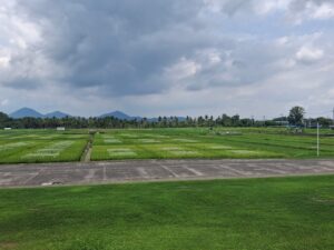
The research on this site focuses on developing climate-resilient rice varieties and improving farming efficiency to withstand extreme conditions, such as floods, droughts, and soil salinity. Research also covers rice area mapping, crop health monitoring, and damage assessment using remote sensing and in situ data.
Project Objectives
Estimating Crop Area
Operational Implementation Plan
Regular acquisition of UAV data (multispectral and thermal) over the rice fields.
Collection of data on rice cropping intensity and crop rotation.
Field size measurement
hectare
Estimating Crop Conditions
Operational Implementation Plan
Collection and analysis of rice spectral signatures from canopy hyperspectral and UAV (multispectral and thermal) data for crop disease early detection and mapping.
Impact assessment of crop stress and disease on the biophysical and biochemical traits using field data measurements.
Crop Conditions
- Drought
- Biological Stress (including pest)
Measuring Phenological Events
Phenological Events
- Seeding
- Seedling
- Vegetative Growth
- Flowering
- Maturity
- Harvest
Estimation of Biophysical Variables
Operational Implementation Plan
Frequent in situ data measurements of rice crop biophysical and biochemical variables.
Modelling key biophysical and biochemical variables of rice crops based on satellite and UAV-derived data combined with in situ measurements.
Biophysical Variables
- LAI (Leaf Area Index)
- Biomass
- Plant height
- Cover density
Forecasting Agricultural Variables
Operational Implementation Plan
Frequent documentation of yield data in the dry and wet planting seasons under different rice varieties, fertilizer rates, water management, and soil fertility conditions.
Agricultural Variables (large scale)
- Yield
Site Description
| Landscape Topography | Peneplain |
|---|---|
| Typical Field Size | 500 m2 |
| Climatic Zone | Tropics, warm |
| Major Crops and Calendars | Rice: Rice: |
| Soil Type & Texture | Inorganic:
|
| Soil Drainage Class | Varied; detailed data available |
| Irrigation Infrastructure | Irrigated |
| Other Site Details |
In Situ Observations
Spectral reflectance
- Crop Type(s): Rice
- Collection Protocol:
Regular UAV flights are carried out weekly, carrying a camera which captures rice canopy spectral reflectance in multispectral and thermal bands. Other derivative features, such as vegetation Indices (NDVI, EVI, SAVI, etc.) and/or textural features will be processed afterwards depending on the purposes of the study.
- Frequency: weekly
Cropping system
- Crop Type(s): Rice
- Collection Protocol:
- Frequency: seasonal
Crop calendar
- Crop Type(s): Rice
- Collection Protocol:
- Frequency: seasonal
Water management
- Crop Type(s): Rice
- Collection Protocol:
- Frequency: seasonal
Yield
- Crop Type(s): Rice
- Collection Protocol:
- Frequency: seasonal
Rainfall
- Crop Type(s): Rice
- Collection Protocol:
- Frequency: daily
Air temperature
- Crop Type(s): Rice
- Collection Protocol:
- Frequency: daily
EO Data
Optical Data Requirements
SAR Data Requirements
Passive Microwave Data Requirements
Thermal Data Requirements
Results
Documents and Files
Links to paper
Documents and Files: (will be updated)
Links to paper:
Doddamani, M., Wang, Z., Ellsäßer, F. J., Castilla, N. P., Laborte, A. G., Nelson, A. D., Klassen, S., & Darvishzadeh, R. (2026). Multi-temporal, multi-modal UAV and machine learning framework for early detection and mapping of Bacterial Leaf Blight in Rice. Paper presented at XXV ISPRS Congress 2026, Toronto, Canada.
Wang, Z., Darvishzadeh, R., Castilla, N. P., Laborte, A. G., & Nelson, A. D. (2026). Hyperspectral assessment of bacterial leaf blight disease in young rice canopies. Poster session presented at 14th EARSeL Workshop on Imaging Spectroscopy, Helsinki , Finland.
Project Reports
Study Team
Team Leader
Other Team Members